Cracking the Code: How Reykjavik's Address System Actually Works (And Why Your GPS Keeps Lying to You)
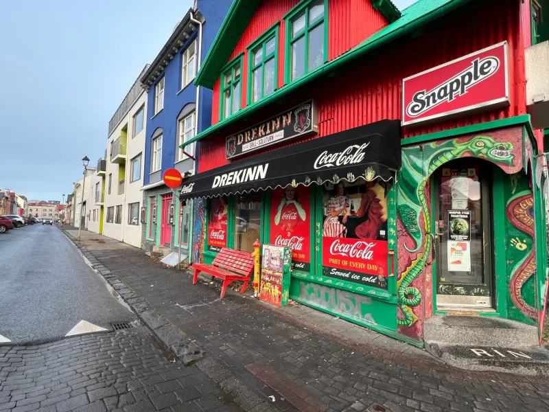
You're standing on a corner in downtown Reykjavik, phone in hand, staring at a street sign that feels like it was designed specifically to confuse you. Your GPS is confidently pointing you toward a building that turns out to be a parking garage. A local walks past, and you're pretty sure they just gave you directions using a word that isn't on any map you downloaded. Welcome to Reykjavik navigation — population: bewildered Americans.
Here's the thing, though. This city isn't actually hard to navigate. It just plays by different rules than the grid-based American cities most of us grew up in. Once you decode those rules, you'll be moving through Reykjavik like you've lived here for years. Let's break it all down.
Why US Visitors Get Confused Immediately
Back home, we're used to addresses that tell a clear story: a number, a street name, maybe a city and zip code. Simple. Logical. Reykjavik doesn't work that way — and the reason goes back to how Icelandic settlements developed historically.
In Iceland, addresses are built around street names and house numbers, but the streets themselves often have names that don't follow any intuitive geographic pattern from an outsider's perspective. Streets end abruptly, curve dramatically, and change names mid-block in ways that feel arbitrary. More importantly, Reykjavik's downtown core is dense and compact in a way that makes numbered grids basically irrelevant — you're rarely more than a ten-minute walk from anything, which means locals have always relied on landmarks and neighborhood context more than strict address logic.
The result: addresses like "Laugavegur 12" or "Skólavörðustígur 4" look perfectly reasonable until you're trying to figure out which direction to walk.
The Street Name System, Explained Simply
Icelandic street names are almost always descriptive — they tell you something about the road's history, geography, or character. "Laugavegur" literally translates to "hot spring road" because it was the old path women walked to reach the washing springs outside the city. "Austurstræti" means "east street." "Bankastræti" references the bank that once anchored that block.
This is actually incredibly useful once you recognize it. If you're on Tjarnargata, you're near the pond ("tjörn" means pond). If you're on Hafnarstræti, you're near the harbor ("höfn" means harbor). The names are geographic breadcrumbs — they just happen to be written in a language most Americans don't speak.
Quick reference for common street suffixes:
- -gata or -stræti = street or road
- -vegur = way or path
- -braut = avenue or boulevard
- -stígur = lane or path (usually smaller)
- -torg = square or plaza
Memorise those and you'll immediately understand what kind of road you're dealing with before you even see it.
House Numbers: Not as Random as They Look
Icelandic house numbering follows a pattern, but it's not always sequential in the way Americans expect. Numbers generally increase as you move away from the city center or along the natural flow of the street, but because streets curve and intersect in non-grid ways, odd and even numbers don't always alternate sides the way they do in most US cities.
The practical fix: when you have an address, always confirm the nearest cross street or landmark. Locals will often give you directions using both — "Laugavegur 20, next to the red building near Klapparstígur" — and that combination is far more reliable than the number alone.
Why Google Maps Fails in Downtown Reykjavik
This one trips people up constantly. Google Maps works reasonably well for Reykjavik in general, but in the dense downtown core — particularly around Laugavegur, Skólavörðustígur, and the streets feeding into Austurvöllur square — it has a frustrating habit of routing you through pedestrian alleys it treats as roads, pointing you at building entrances that don't exist on the street-facing side, or simply miscalculating walking times because it doesn't account for Reykjavik's elevation changes.
The hills matter more than they look on a flat map. The climb up toward Hallgrímskirkja church is steeper than any app currently communicates, and several "shortcuts" the algorithm loves involve staircases or gravel paths that aren't viable in rain or wind (which, in Reykjavik, is most of the time).
Better alternatives to GPS-only navigation:
- Download the Reykjavik City Map app before you arrive and use it offline
- Screenshot your destination's location on Google Maps while you have signal, then navigate by landmark
- Use the Hallgrímskirkja church tower as your constant north star — it's visible from almost everywhere in the center and sits slightly east of true center, which helps orient you
- The harbor is always north. The hill is always inland. Once you internalize those two facts, you can self-correct without any signal at all
A Foolproof System for Asking Locals for Directions
Icelanders are genuinely helpful when asked for directions, but the way you phrase your question makes a huge difference in the quality of answer you get.
Don't ask: "How do I get to Laugavegur 56?" Do ask: "I'm looking for [specific business name] on Laugavegur — do you know roughly which direction that is from here?"
Locals navigate by business names and landmarks far more reliably than by address numbers. If you're looking for a specific café, hotel, or shop, lead with its name. Most people in the city center will recognize it immediately.
Also useful: carry a printed map. This sounds old-fashioned, but Reykjavik's tourist information centers distribute excellent free paper maps, and pulling one out when asking for directions gives locals something to point at — which produces dramatically better results than trying to interpret verbal directions in an unfamiliar city.
Real Examples to Practice With
Here's a quick exercise. Before your trip, look up these addresses and try to identify them using only the street name clues:
- Tjarnargata 11 — You're near the city pond, which means you're close to Reykjavik City Hall
- Hafnarstræti 15 — Harbor street, so you're in the waterfront district near the old center
- Skólavörðustígur 1 — "School guard path" — this runs directly up toward Hallgrímskirkja
Spend ten minutes with a map before you land, tracing these streets visually, and Reykjavik's layout will click into place faster than you'd expect.
The Bigger Picture
Reykjavik is a small city that rewards walkers who pay attention. The address system isn't broken — it's just different. And different, in this case, means layered with history and geography that actually makes the city more interesting to explore once you know how to read it.
Lose the expectation of American-style grid logic, lean into the landmark-based navigation that locals use naturally, and treat every street name as a tiny piece of cultural information. You'll spend less time staring at your phone and more time actually seeing the city — which is, after all, the whole point.