Walk This Way: Five Themed Routes That Let You Build Your Own Reykjavik Adventure
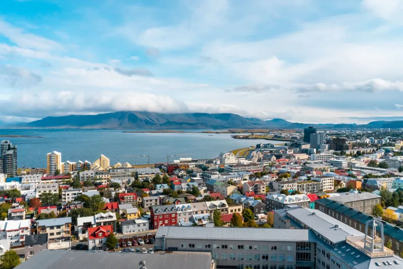
Here's the thing about Reykjavik that most travel guides don't fully communicate: the city is small. Genuinely, surprisingly small. The entire downtown core is walkable in about twenty minutes at a casual pace, which means the traditional "Day 1, Day 2, Day 3" itinerary structure that works for Paris or Tokyo is kind of overkill here.
What Reykjavik actually rewards is flexible, theme-based exploration — choosing a direction based on what you're curious about that day, following it until you're satisfied, and then pivoting somewhere else. Weather changes fast here, energy levels fluctuate (especially with the midnight sun messing with your sleep), and the best discoveries tend to happen when you're not rigidly committed to a schedule.
These five walking routes are designed for exactly that kind of exploration. Each one has a theme, a rough length, and a set of anchor points to keep you oriented. But none of them require you to follow a precise sequence — treat them as frameworks, not instructions.
Route 1: The Waterfront Walk — Where the City Meets the Sea
Approximate distance: 2.5 miles | Estimated time: 1.5–2.5 hours | Difficulty: Easy, mostly flat
Start at Harpa Concert Hall, the glass-and-steel landmark at the eastern edge of the harbor. Spend a few minutes with the exterior — the geometric façade changes completely depending on the light and weather, and on a clear day it reflects the mountains across the bay in a way that's genuinely worth pausing for.
From Harpa, follow the waterfront path west along Geirsgata. You'll pass the Sun Voyager sculpture (Sólfar) — yes, it's on every postcard, but the views of Mount Esja from this spot earn the tourist attention. Keep moving west toward the Grandi district, which is where Reykjavik's waterfront really opens up into something interesting.
Grandi was a working fishing and industrial harbor until relatively recently, and you can still feel that history in the bones of the neighborhood even as it's been transformed by design studios, seafood restaurants, and the excellent Reykjavik Maritime Museum. The Whales of Iceland exhibition is here too, if you want to add an indoor stop.
End the route at Grandagarður street, where you can grab food at one of the casual seafood spots before heading back toward the center via Mýrargata.
Best in: Clear weather, late afternoon when the light on the harbor is extraordinary. Also works well on overcast days — the industrial Grandi aesthetic suits grey skies.
Route 2: The Architecture Trail — Reading Reykjavik's Built History
Approximate distance: 1.5 miles | Estimated time: 1–2 hours | Difficulty: Moderate (one significant uphill section)
This route works as a visual timeline of Reykjavik's development, moving from the oldest surviving structures in the city center up to the iconic modernist landmarks on the hill.
Begin at Austurvöllur square, the historic heart of Reykjavik. The Alþingi (Parliament building) on the east side dates to 1881 and is one of the oldest public buildings in the city. The Dómkirkjan (Cathedral of Iceland) next door is even older — completed in 1796. Take a moment to appreciate how compact this civic center is. In American terms, it would barely qualify as a town square.
Move south along Kirkjustræti and then east on Lækjargata toward Tjörnin, the city pond. The buildings lining the pond's northern edge include some of the best examples of early 20th-century Reykjavik residential architecture — look for the corrugated iron cladding that became an Icelandic signature when timber was scarce.
From the pond, head uphill along Skólavörðustígur — this is your significant climb, but the payoff is Hallgrímskirkja, the expressionist church that dominates the Reykjavik skyline. The building took 41 years to complete and was designed by Guðjón Samúelsson, who drew inspiration from the basalt lava columns found throughout Iceland. Stand across the street on Eiríksgata and look at the façade head-on. Then look at a photo of Icelandic basalt columns. The connection is unmistakable.
Best in: Any weather. The architecture reads well in all conditions, and the uphill section is short enough that even a rainy day doesn't make it unpleasant.
Route 3: The Neighborhood Drift — Laugavegur and Beyond
Approximate distance: 2 miles | Estimated time: 2–3 hours | Difficulty: Easy
Laugavegur is Reykjavik's main commercial street and gets a lot of tourist foot traffic — but this route uses it as a spine rather than a destination, ducking off into the side streets where the city's neighborhood character actually lives.
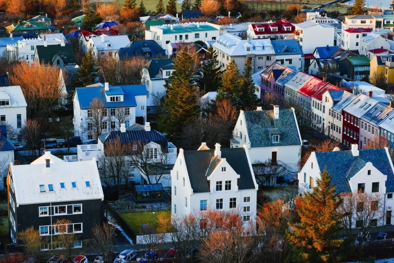
Start at the Laugavegur/Klapparstígur intersection and walk east. Every block or so, peel off onto a side street for a few minutes before returning to the main drag. Þingholtsstræti heading south is quieter and residential, with good examples of the colorful corrugated-iron houses Reykjavik is known for. Njarðargata heading north takes you toward the pond and a more civic feel.
At the top of Laugavegur where it meets Snorrabraut, turn onto Hverfisgata and walk it back west. This parallel street is less visited and more interesting in a lot of ways — galleries, independent shops, and cafés that skew heavily local. The contrast with Laugavegur, just one block south, is striking.
Finish the route at Hlemmur Mathöll, the converted bus terminal turned food hall, which makes an excellent stop for a meal or a coffee and some people-watching.
Best in: Daytime, when shops and cafés are open and the street life is active. Avoid early morning if you want the full neighborhood experience.
Route 4: Local Life — The 101 Reykjavik Residential Experience
Approximate distance: 2 miles | Estimated time: 1.5–2 hours | Difficulty: Easy
This route intentionally avoids the main tourist corridors and focuses on the residential streets of the 101 postal district — the neighborhoods where people actually live, shop, and go about their days.
Start at Tjörnin (the city pond) and walk south along Tjarnargata. You'll pass the National Museum of Iceland and then move into quieter streets heading toward Meðalholt and Háholt — small residential blocks with gardens, parked bikes, and almost no tourist infrastructure whatsoever.
Loop back north via Bragagata and Bergþórugata, keeping an eye out for the community garden plots and the small playgrounds that tell you this is a neighborhood built for people who live here year-round, not just visitors. The scale of the houses — many of them small by American standards — gives you a real sense of Reykjavik's size and the density of daily life in the city center.
End at Frakkastígur, which connects back to the Laugavegur area if you want to transition into Route 3, or head north toward the harbor if the waterfront is calling.
Best in: Morning or early afternoon. Weekend mornings especially, when the residential streets have a quiet, unhurried energy that's hard to find elsewhere in the city center.
Route 5: The Hidden Layer — Courtyards, Alleys, and Off-Map Discoveries
Approximate distance: 1.5 miles | Estimated time: 1.5–2.5 hours | Difficulty: Easy, but requires attention
This is the route for people who like to look up, look down, and look sideways. Reykjavik has a surprising number of interior courtyards, narrow passages, and semi-hidden spaces that don't appear on standard tourist maps.
Begin on Austurstræti and immediately look for the passage that cuts through to Ingólfsstræti — a narrow alley that most visitors walk past without noticing. From there, explore the blocks between Aðalstræti (the oldest street in Reykjavik, where archaeological remains of the first Norse settlement have been found) and Vesturgata, where the building density creates interesting micro-spaces between structures.
Make your way toward the Kolaportið flea market area near the harbor — on weekends it's open and worth an hour of wandering through local secondhand goods, vintage clothing, and traditional Icelandic food items. On weekdays, the exterior of the building and the surrounding dock area still reward exploration.
Finish by walking the length of Aðalstræti slowly, reading the interpretive markers about the settlement history beneath your feet. Iceland's first permanent resident is believed to have settled near here in the 9th century. That context, layered under a modern capital city, is the hidden story this route is designed to surface.
Best in: Weekend mornings if you want the flea market. Any time for the historical layer — it doesn't require good weather or open businesses.
How to Use These Routes Together
The beauty of Reykjavik's scale is that these routes connect naturally. You can finish Route 1 and walk directly into Route 5 without retracing a single step. Route 2's endpoint at Hallgrímskirkja is a ten-minute walk from Route 3's starting point. On a day with variable weather, you can do half of one route, duck inside somewhere warm, and pick up a different route entirely when the sky clears.
Bring a downloaded offline map, pick a starting point that feels right for your energy level that day, and let the city do the rest. Reykjavik is small enough to be forgiving and interesting enough to reward attention. That combination is rarer than it sounds.